About
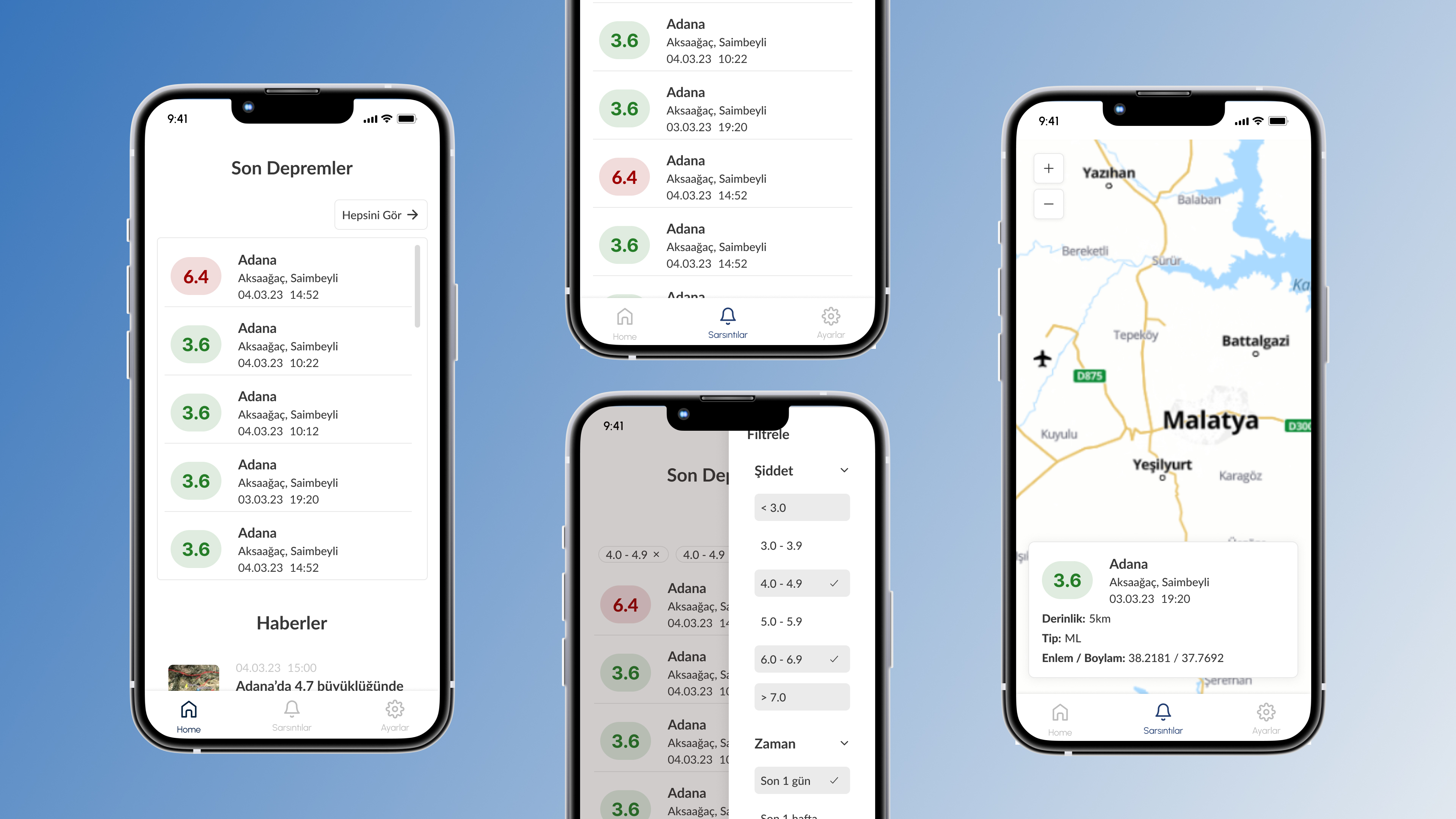
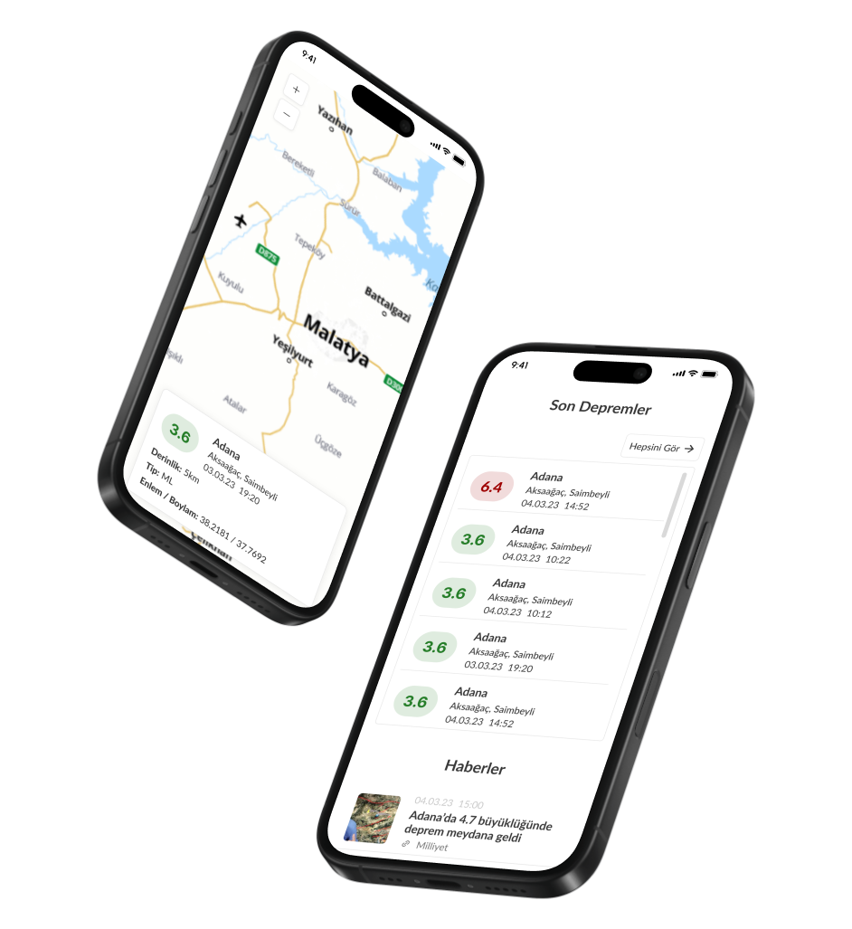
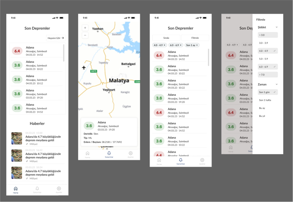
This mobile application came to my mind after I experienced a horrible earthquake in 2023. I realized that it is very important to get the right information after every big or small earthquake. I also realized that younger generations can handle dealing with bad UI, however it was so hard for my older aunts and grandparents to understand if the magnitutde was dangerous or not. This is why, this mobile application interface is designed to display recent earthquake information in a user-friendly and structured manner. The project focuses on providing clear and accessible earthquake data, allowing users to stay informed about seismic activities in their area or other regions. A detailed list displaying recent earthquakes, including magnitude, location, and timestamp are also very needed. Color-coded magnitudes to help users quickly assess the severity of events is included. Users can filter earthquake data by magnitude or specific timeframes and a bottom navigation bar ensures smooth tran